LIDAR Magazine
Latest News
05.03.2024
Emlid and Pix4D Launch Mobile Terrestrial Scanning Kit to Accelerate Data Capture
05.03.2024
Descartes Labs Government Accelerates Mission-Ready Solutions with EarthDaily Constellation Earth Observation Data
05.03.2024
NOAA Digital Coast Celebrates Two Major Milestones
05.02.2024
Webinar: Mapping Hilly Terrains With Drones: Is It Possible?
04.30.2024
Descartes Labs Welcomes Keith Masback to Board of Directors
04.30.2024
Pix4D Upgrades PIX4Dcatch with Premium Augmented Reality Features for Professional Results
04.29.2024
Global Marketing Insights to Present GEOINT 2024 Workshop on Protecting Global Supply Chains from Cyber and Kinetic Attacks
04.29.2024
Airbus Expands its Earth Observation Constellation with Pléiades Neo Next
04.29.2024
Program Announced for GEO Business 2024
04.24.2024
LMU Munich Institute for Digital Cultural Heritage Studies Makes the Past Visible with RIEGL UAV-Based LiDAR
04.24.2024
Descartes Labs Government Launches Retina at GEOINT 2024
04.23.2024
Creaform Elevates Portable 3D Scanning Capabilities with Enhanced HandySCAN 3D
04.18.2024
Virtual Surveyor Adds Planimetric Survey Functionality to Latest Release of Smart Drone Surveying Software
04.17.2024
Contribution to Topo-Bathymetric Laser Scanning Honored with DGPF Prize
04.16.2024
Woolpert Implements Cityworks Online Asset Lifecycle Management Solution for Metroparks Toledo
04.15.2024
SimActive Integrated with Multi-Camera Systems for Precision Photogrammetry
04.14.2024
Woolpert Hires Market Director Kristi Norman
04.14.2024
The 59th Photogrammetric Week
04.11.2024
Woolpert Implements Rapid Ready Asset Lifecycle Management Solution for West County Wastewater
04.11.2024
New Diamond DA62 MPP SurveyStar for the RIEGL Test Aircraft Fleet
04.10.2024
Woolpert Hires Accomplished Business Development Leader William Marbell as Geospatial Program Director
04.09.2024
Creaform Introduces MetraSCAN BLACK+ and MetraSCAN BLACK+|Elite
04.08.2024
Space Flight Laboratory Confirms Successful Deployment of HawkEye 360 Microsatellite Clusters 8 and 9
Features
Latest Issue
Volume 14 Issue 2 // May 2024
Departments
From the Editor
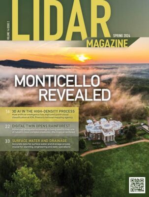
A Digital Record
Our cover story is about an archaeological application. Well-known geospatial services company Surdex1 was contracted by the Thomas Jefferson Foundation to acquire lidar…
Full Coverage
Full Coverage: The Case For (And Against) Propagated Uncertainty in Aerial Topographic LiDAR
There is a strong case for adding Total Propagated Uncertainty to the LAS specification, but it would almost certainly increase cost. The Geo…
From the Editor
A Digital Record
Our cover story is about an archaeological application. Well-known geospatial services company Surdex1 was contracted by the Thomas Jefferson Foundation to acquire lidar…
Full Coverage
Full Coverage: The Case For (And Against) Propagated Uncertainty in Aerial Topographic LiDAR
There is a strong case for adding Total Propagated Uncertainty to the LAS specification, but it would almost certainly increase cost. The Geo…